I started the new year with a piece of art to begin a conversation. The piece:
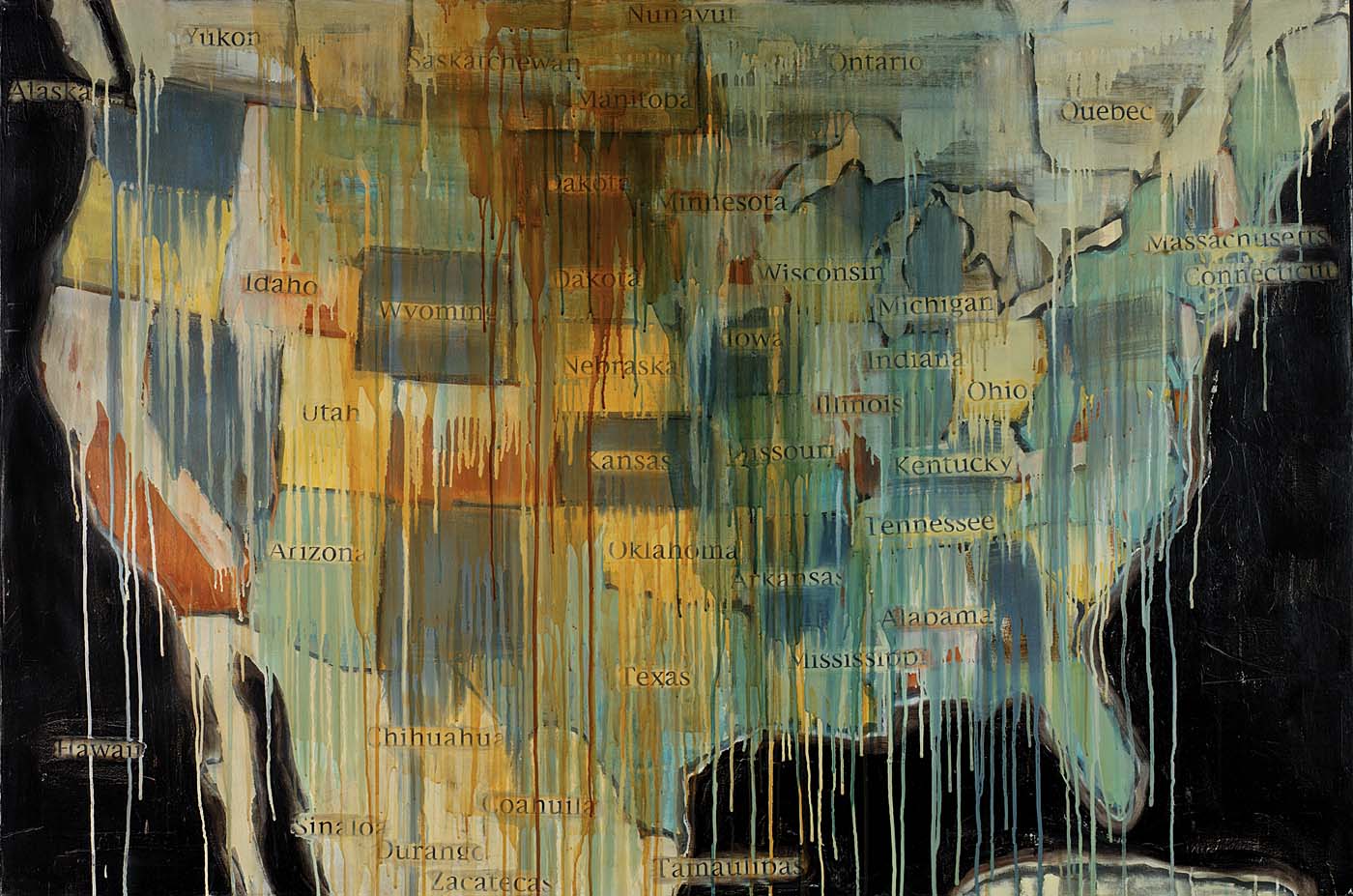
State Names; 2000; Jaune Quick-To-See Smith; Born: St. Ignatius, Montana; 1940; oil, collage and mixed media on canvas; 48 x 72 in. (121.9 x 182.9 cm); Smithsonian American Art Museum Gift of Elizabeth Ann Dugan and museum purchase; 2004.28; Smithsonian American Art Museum
Here are some of their insights:
It has a rusty red color on the top of it to represent the war
A new generation is coming and the old generation is being stripped away
Caging in America
Chaotic Unification
It looks like it is all moving together into one
Dying … disintegrating … falling apart … no one knows what’s going on
Some names have drips covering them but the others seem to pop out
It looks like melting wax
Something is spreading down, like war or migration
Bloody death
It looks like war. And it looks like everything is falling apart.
The top right states look like the drops are icicles
Blood running down Dakota… most bloodshed there
The oceans are black yet the Great Lakes are grey
Everything to the east side has no borders … like one big state
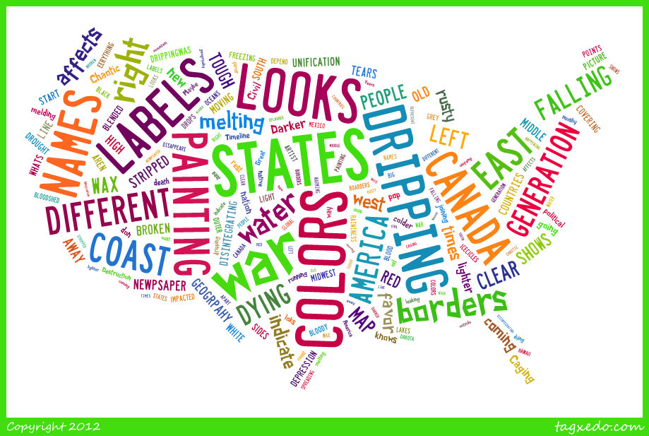
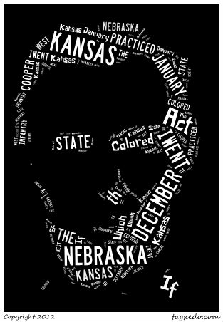
I played with Tagzedo to create a word cloud of their observations.