• Home
  • About
  • How to Contribute
  • Our Correspondents

7

Jun

10

Battle of Cynthiana: June 11-12, 1864

Posted by mckelveb  Published in Civil War (1861-1865), Maps, Places to Visit, Rare Books Themes: Battles & Soldiers

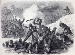
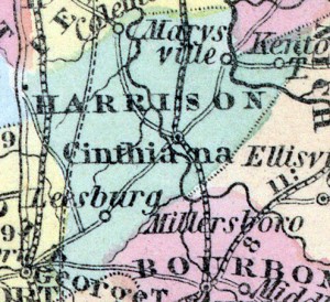
The Battle of Cynthiana (also known as Kellar’s Bridge) took place on June 11-12, 1864 in Harrison County, Kentucky.  The National Park Service ’s website includes a brief summary regarding the battle and the Civil War Sites Advisory Commission provides a map detailing the location of each battleground within the state as well as an overview on the condition of each individual site.  The Cynthiana battleground has over eight hundred acres of land intact that would make field trips and walking tours of the area possible.  On June 11, Confederate General John Hunt Morgan and his forces attacked General Edward Hobson and the 171st Ohio National Guard, taking over one thousand prisoners of war captive.  The following day, Union General Stephen Gano Burbridge along with the 168th Regiment Ohio Volunteer Infantry and the Kentucky Harrison County Home Guards attacked the Confederate forces at dawn and drove them back.  Collins’ Historical Sketches of Kentucky: History of Kentucky, Volume 2 described the scene of the battle:

“Fatigued as they were by the previous day’s operations- which resulted in the defeat and capture of two distinct Federal forces- the Confederates were not in condition to withstand the shock of a fresh body of troops.  Burbridge, with his cavalry, was enabled to flank them, and thus turn their lines; while his infantry, in the center, advanced steadily, forcing them back on the town.  The fighting commenced on Millersburg pike, about one mile east of Cynthiana.  But the Confederates- unable to hold out against the rapid and determined advance of superior numbers of fresh troops supported by artillery- soon gave way, and, by the time they reached Cynthiana, were in full retreat, and the retreat a rout.  One by one, they fell back through the town, crossed the river, and followed the Raven Creek pike.  Thus ended the battle that was fought at Cynthiana in the war for southern independence.”

Some suggestions for further reading on the Battle of Cynthiana include Chronicles of Cynthiana which gives a fairly concise overview of the second battle at the site.  Other interesting resources are the Official Records and the History of Morgan’s Cavalry which provides background information on General Morgan’s early life and his participation in the Confederate army.

no comment

4

Jun

10

Siege of Vicksburg, Mississippi

Posted by sailerd  Published in Civil War (1861-1865), Historic Periodicals, Images, Letters & Diaries, Maps, Places to Visit Themes: Battles & Soldiers

Within twenty four hours of the Union’s victory at Gettysburg, Pennsylvania in July 1863, Confederate General John C. Pemberton surrendered his forces at Vicksburg, Mississippi on July, 4, 1863 to General Ulysses S. Grant after a long siege. Vicksburg is a city located along the Mississippi River and the Confederacy’s loss of such an important port was a serious loss. Teachers should check out the great resources on National Park Service’s page and in their online exhibit, which are described in an earlier post. House Divided has several interesting documents that offer a variety of perspectives on Vicksburg, including a Confederate private who told his wife what he believed was responsible for the defeat. General Pemberton’s forces surrendered “on the account of provisions,” as Private William Stoker explained. Stoker, who was with General John Walker’s Texas Division in Louisiana when he heard about Vicksburg, argued that “[the Union] could [never] of whipped us there if we…of had [enough] provisions.” General William T. Sherman, who also participated in the Vicksburg Campaign, reflected after the war on some negative consequences of the Union’s victory:

“But our success at Vicksburg produced other results not so favorable to our cause a general relaxation of effort, and desire to escape the hard drudgery of camp: officers sought leaves of absence to visit their homes, and soldiers obtained furloughs and discharges on the most slender pretexts; even the General Government seemed to relax in its efforts to replenish our ranks with new men, or to enforce the draft, and the politicians were pressing their schemes to reorganize or patch up some form of civil government, as fast as the armies gained partial possession of the States.”

In addition, this short newspaper article from the Vicksburg Whig provides a nice example of the way southern editors portrayed Union soldiers’ conduct during the campaign. You can find other primary sources in the Vicksburg Campaign major topic at House Divided as well as in volume 15 of the Official Records.

no comment

3

Jun

10

The Battle of Chancellorsville, April 30-May 8, 1863.

Posted by solnitr  Published in Civil War (1861-1865), Images, Letters & Diaries, Maps, Places to Visit, Recent Scholarship Themes: Battles & Soldiers

Confederate forces under the command of General Robert E. Lee and Maj. Gen. Thomas “Stonewall” Jackson had 40,000 fewer soldiers fighting at the Battle of Chancellorsville, Virginia than Maj. Gen. Joseph Hooker’s Union troops.  Nonetheless, General Lee executed what historian John Murrin has labeled “the riskiest operation of his career” coming out victorious on May 8, 1863 after seven days of fighting.  William Swinton, in his 1882 analysis Campaigns of the Army of the Potomac, credits Hooker with the mistake of taking a defensive stance and leaving his “right flank thrown out ‘in the air,’” and giving Lee the opportunity to attack.  The Civil War Preservation Trust provides an interactive map of the battle, which shows the forces’ movements over the course of May 1st.  Though the Confederacy won the Battle of Chancellorsville, Stonewall Jackson was mortally wounded by his own troops on May 2nd, “the event of the Chancellorsville conflict which caused intense sorrow to the enemy [the Confederate troops],” according to Samuel Bates’ The Battle of Chancellorsville (1882), and “was regarded as entailing the greatest injury to their cause.”  The Virginia Military Institute, where Jackson was a member of the faculty from 1851 until 1861, has an online research center with an extensive Stonewall Jackson exhibit. Their Jackson exhibit includes a photo gallery, a collection of Jackson’s papers available as originals or transcriptions, a Jackson family genealogy, as well as an informational timeline and biography. The Battle of Chancellorsville has also been preserved as part of the Fredericksburg and Spotsylvania County Battlefields Memorial by the National Parks Service.  The NPS website includes a wide variety of resources for teachers including “troop position maps” for May 2nd and May 3rd, links to General Lee and Hooker’s official reports, as well as an extensive list of suggested readings on the battle which range from firsthand accounts to children’s books.

no comment

2

Jun

10

The Battle of Monocacy- July 9, 1864

Posted by mckelveb  Published in Civil War (1861-1865), Images, Maps, Places to Visit, Rare Books Themes: Battles & Soldiers

The Battle of Monocacy on July 9, 1864 in Frederick County, Maryland became known as “The battle that saved Washington” as it gave supporting Union troops more time to fill the area and defend the Capital.  The National Park Service ’s website provides resources including a short summary of the battle and a map that shows the location of the battle as well as a detailed overview regarding the preservation of the site.  The Confederate forces were led by Lieutenant General Jubal A. Early whose memoir provides an interesting account of the battle from the Confederate perspective.  Major General Lew Wallace (who later on became better known as the author of the novel Ben Hur) and the Union forces attempted to arrest Early and the Confederate forces, but were defeated.  General Ulysses S. Grant highlighted the importance of the battle through an excerpt from his memoir:

“If Early had been but one day earlier, he might have entered the Capital before the arrival of the reinforcements I had sent.  Whether the delay caused by the battle [Monocacy] amounted to a day or not, General Wallace, on this occasion, by the defeat of the troops under him, contributed to a greater benefit to the cause than often falls to the lot of a commander of an equal force to render by means of a victory.”

There are several other interesting books which could be valuable to learning about the Battle of Monocacy from both the Union and Confederate perspectives.  Along with Early’s memoir, John H. Worsham’s One of Jackson’s Foot Cavalry: His Experience and What He Saw During the War 1861-1865 provides a valuable first hand narrative of the author’s experience as a Confederate soldier who fought in the Battle of Monocacy.  Also, The Land We Love, Volume II is available in full view on Google Books and contains Confederate General Gordon’s report on the battle which may be worthwhile to look at as it also contains reports and correspondence between other Confederate officials.  Since the Civil War Sites Advisory Commission has made the preservation of the Monocacy National Battlefield  one of its top priorities the park holds over one thousand acres and five walking trails which could provide for an interesting field trip .

no comment

1

Jun

10

Fort Pillow Massacre- April 12, 1864

Posted by mckelveb  Published in Civil War (1861-1865), Maps, Rare Books, Recent Scholarship Themes: Battles & Soldiers

The Confederate Army attacked Fort Pillow in Lauderdale County, Tennessee on April 12, 1864 in a fight that later became known as the Fort Pillow Massacre since the lives of few Union soldiers were spared.  The National Park Service’s website gives a valuable overview of the fight and its commanding figures in its battle summaries section as well as a map that outlines the territory covered under the website’s Civil War Sites Advisory Commission Report Update and Resurvey.  There is also a concise overview of African American Participation in the Civil War located on the website.   Led by Major General Nathan Bedford Forrest, Confederate forces attacked Fort Pillow which was protected by 295 white Tennessee troops and 262 United States Colored Troops.  Union Army Major Lionel F. Booth was killed during the battle and command was subsequently taken over by Major William F. Bradford.  The atrocities committed by the Confederates were best described by The Rebellion Record:

“Then followed a scene of cruelty and murder without parallel in civilized warfare, which needed but the tomahawk and scalping- knife to exceed the worst atrocities over committed by savages.  The rebels commenced an indiscriminate slaughter, neither sparing age nor sex, white nor black, civilian or soldier.  The officers and men seemed to vie with each other in the devilish work; men, women, and even children, wherever found, were deliberately shot down, beaten, and hacked with sabres; some of the children not more than ten years old were forced to stand up and face their murderers while being shot; the sick and the wounded were butchered without mercy, the rebels even entering the hospital building and dragging them out to be shot or killing them as they lay there unable to offer the least resistance.”

Some other sources that may be valuable to further research on Fort Pillow and can be accessed through Google Books are The War of the Rebellion: A Compilation of the Official Records of Union and Confederate Armies as it gives mention of activity at the fort prior to the attack and A History of the Negro Troops in the War of the Rebellion, 1861-1865: Preceded by a Review of the Military Services of Negroes in Ancient and Modern Times which gives an interesting account of the scene at Fort Pillow through the eyes of an African-American soldier.  In terms of modern scholarship, John Cimprich’s Fort Pillow, a Civil War Massacre and Public  Memory provides valuable maps which could help gain a better understanding of the area surrounding the fort.

no comment

1

Feb

10

Iowa Counties Historic Atlases

Posted by sailerd  Published in 19th Century (1840-1880), Images, Maps Themes: Settlers & Immigrants

Iowa

The University of Iowa’s Digital Library contains a number of different digital projects, including “Iowa Counties Historic Atlases.” One can find almost 100 county atlases published between the late 1800s and the early 1900s. Each county atlas, such as one for Des Moines county, offers different county maps, city maps, a wide variety of illustrations, and historical sketches.

no comment

18

Dec

09

American Geographical Society Library – Digital Map Collection

Posted by sailerd  Published in 19th Century (1840-1880), Maps Themes: US & the World

agsl2

While I highlighted House Divided’s map collection a few weeks ago, another great resource is the American Geographical Society Library Digital Map Collection. One can look through over 500 maps from around the world as well as from different eras (15th – 21st century). This collection has lots of interesting maps to check out, such as world maps from 1818,  1850s, and 1890s, as well as city maps of major US cities like Chicago, New Orleans, and New York (1840 and 1871). The University of Wisconsin-Milwaukee Libraries hosts this collection and a number of other digital projects as well.

1 comment

9

Dec

09

Immigration to the United States

Posted by sailerd  Published in 19th Century (1840-1880), Images, Letters & Diaries, Maps, Rare Books Themes: Settlers & Immigrants, US & the World, Women & Families

2

Harvard University’s Immigration to the United States, 1789-1930, which is available through their Open Collections Program, is a great resource that offers interesting primary sources that one cannot easily find elsewhere. This collection offers a wide range of material, including photographs, manuscripts, and books and pamphlets. While the focus is on immigration between 1789 and 1930, there is plenty of information on issues related to the Civil War era. One can browse the collection by theme (including “Immigration, Railroads, and the West” and “Gold Rush”) and topic (including Attitudes Towards Immigrants, Living Conditions, Reasons for Immigration, Working Conditions). Also check out their map collection and links to other digital resources on this subject.

1 comment

20

Nov

09

Mitchell's New Universal Atlas, 1857

Posted by sailerd  Published in 19th Century (1840-1880), Images, Maps Themes: US & the World

HD_Europe1

While my last post was on House Divided’s “zoomable” maps , we also have almost all of the maps from Mitchell’s 1857 atlas available. This includes all the US states and territories as well as countries and major cities from around the world. For example, check out the maps of Africa, Asia, Australia, the Carribean, Europe, England, Jerusalem, London, the Middle East, and South America. These maps can help students see how those in the 19th century saw the world that they lived in.

3 comments

18

Nov

09

Zoomable Maps

Posted by sailerd  Published in 19th Century (1840-1880), Maps Themes: US & the World

Example

As this is Geography Awareness Week, I thought I would highlight some of the zoomable maps available on House Divided. Some of these maps provide bird-eyes view of various towns and cities – including Alton, Cedar Rapids, Des Moines, Harrisburg, New York, Philadelphia, Providence, and Washington D.C. In the Springfield map, you can look for Abraham Lincoln’s house (# 29 on the map). Other maps provide nice overviews of coastlines, such as Louisiana, the Carolinas, and Virginia. House Divided also has zoomable maps of battlefields, including several of Gettysburg. Click on “Zoomify” at the top right of a map in House Divided in order to view it as a zoomable map.

no comment
Page 4 of 6« First«...23456»

Search

Categories

  • Dickinson & Slavery
  • History Online
  • Period
    • 19th Century (1840-1880)
    • Antebellum (1840-1861)
    • Civil War (1861-1865)
    • Reconstruction (1865-1880)
  • Type
    • Editor's Choice
    • General Opinion
    • Historic Periodicals
    • Images
    • Lesson Plans
    • Letters & Diaries
    • Lists
    • Maps
    • Places to Visit
    • Rare Books
    • Recent News
    • Recent Scholarship
    • Recollections
    • Video
  • What Would Lincoln Do?

Project Links

  • Digital Lincoln
  • HDiv Research Engine
  • House Divided Index
  • L-D Debates Classroom
  • Lincoln in PA
  • PA Grand Review
  • UGRR Classroom
  • Virtual Field Trips
  • William Stoker Exhibit

Administration

  • Log in
  • Entries feed
  • Comments feed
  • WordPress.org
Donate

Recent Post

  • Black Employees and Exclusive Spaces: The Dickinson Campus in the Late 19th Century
  • Friend or Foe: Nineteenth Century Dickinson College Students’ Perception of Their Janitors
  • Teaching Gettysburg: New Classroom Resources
  • Coverage of the Gettysburg Address
  • Welcome to Chicago: Choosing the Right Citation Generator
  • Augmented Reality in the Classroom
  • Beyond Gettysburg: Primary Sources for the Gettysburg Campaign
  • African Americans Buried at Gettysburg
  • The Slave Hunt: Amos Barnes and Confederate Policy
  • Entering Oz – Bringing Color to History

Recent Comments

  • George Georgiev in Making Something to Write Home About
  • Matthew Pinsker in The Slave Hunt: Amos Barnes and Confederate Policy…
  • linard johnson in Making Something to Write Home About
  • Bedava in The Slave Hunt: Amos Barnes and Confederate Policy…
  • Adeyinka in Discovering the Story of a Slave Catcher
  • Stefan Papp Jr. in Where was William Lloyd Garrison?
  • Stefan Papp Jr. in Where was William Lloyd Garrison?
  • Jon White in Albert Hazlett - Trial in Carlisle, October 1859
  • Pedro in Discovering the Story of a Slave Catcher
  • Matthew Pinsker in Register Today for "Understanding Lincoln," a New …

by Wired Studios, Corvette Garage, Jeff Mummert
© Content 2007-2010 by Dickinson College