• Home
  • About
  • How to Contribute
  • Our Correspondents

28

Jun

10

The Stevens & Smith Historic Site

Posted by rainwatj  Published in Antebellum (1840-1861), Images, Places to Visit, Recent News Themes: Slavery & Abolition

Thaddeus Stevens, one of the most powerful and controversial congressmen of the nineteenth century is the central figure of a large restoration project conducted by the Historic Preservation Trust of Lancaster County, Pennsylvania. Stevens was an adamant opponent of slavery and helped runaway slaves escape, even going so far as to employ spies to watch for slave-catchers.  He was also a leading attorney in several fugitive slave cases, most notably the Christiana Treason Trial (1851). Stevens also shared his home with Lydia Hamilton Smith, a mixed race woman who managed his household affairs and also proved to be an enormously successful businesswoman herself.

The Stevens & Smith Historic site is a $20 million educational and interpretive complex, integrating the restored 19th century properties of Stevens and Smith located in historic downtown Lancaster, Pennsylvania featuring an original cistern discovered in 2003 believed by historians and archeologists to have been used by Stevens and Smith as a hiding place for escaping slaves along the Underground Railroad. A cistern is an underground storage tank used for holding water.

The planning for the Stevens & Smith Historic site overcame several obstacles before its approval, specifically the original plans for a new downtown convention center in Lancaster, Pennsylvania calling for the demolition of the historic sites previously owned and managed by Stevens and Smith. The Historic Preservation Trust of Lancaster County possessed protective easements on the properties and were successful in developing a strategy for the preservation of Stevens’ Lancaster city law office and residence from the antebellum period within the new Lancaster County Convention Center.

For more information check out the Stevens & Smith Historic Site online for a full overview and updates on the project. The site also features a video on the story of Stevens & Smith and images of the proposed historical site.  Fergus Bordewich’s article, “Thaddeus Stevens and James Buchanan – How Their Historic Rivalry Shaped America” is a great source for historical background on Stevens’ and Smith’s contributions and connections to the abolitionist movement in Lancaster.  Further information can be found on the Thaddeus Stevens Society website including an overview of the archeological dig of the cistern conducted outside Stevens’ residence and law office. The address for the site is located at 45-47 South Queen Street Lancaster, Pennsylvania.
no comment

28

Jun

10

The Underground Railroad in Columbia, Pennsylvania

Posted by solnitr  Published in 19th Century (1840-1880), Images, Places to Visit, Rare Books Themes: Battles & Soldiers, Slavery & Abolition

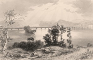
Nineteenth-century historian Robert Clemens Smedley labeled the town of Columbia, Pennsylvania as the birthplace of the organized structure that we now know as the Underground Railroad.  Smedley’s posthumously published account of the Underground Railroad’s presence in Pennsylvania, History of the Underground Railroad in Chester and the Neighboring Counties of Pennsylvania (1883), is available on Dickinson College and Mercersville University’s digital collection: “Slavery & Abolition in the US: Select Publications of the 1800s .”  Smedley narrates the story of the Underground Railroad with Columbia as a key station on the Underground Railroad because of its proximity to the Pennsylvania-Maryland border, just across the Susquehanna River. The Wright family, which founded Columbia in 1726, maintained a sympathetic ear towards the abolitionist cause reflecting their Quaker background. Today the Wright family home, Wright’s Ferry Mansion , is open to the public for tours. The founder’s grandson, William Wright, “an uncompromising hater of slavery,” became one of the first established agents of the Underground Railroad, setting up a network for escaping slaves in Columbia.  Fergus M. Bordewich, author of the comprehensive Underground Railroad book Bound for Canaan (2005) mentions Wright briefly as “hitting on the idea of passing fugitives along from one home to another at intervals of ten or twenty miles, with other friends designated to pilot them in between.” Wright’s network included Robert Loney (or Loonee), a free black man who “ferried fugitives across the [Susquehanna] river in the night at various places below Columbia, and gave them into the care of William Wright.” Loney went on to join Company I of the 32nd Regiment of the USCT in 1864 and is buried in Columbia’s recently restored Zion Hill Cemetery (5th & Linden Streets, Columbia, PA), the burial place of many local black Civil War veterans.  The Pennsylvania “Quest for Freedom ” tour, which maps the historic locations of abolition-related sites from Philadelphia to Chambersburg, includes a stop in Columbia that highlights the Zion Hill Cemetery.  The USGenWeb Tombstone Transcription Project also includes a Zion Hill webpage with recent photos of fourteen USCT headstones.

no comment

24

Jun

10

The Soldiers Monument

Posted by mckelveb  Published in Places to Visit, Reconstruction (1865-1880) Themes: Battles & Soldiers, Carlisle & Dickinson

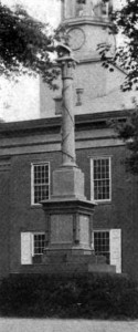
The Soldiers Monument in Carlisle, Pennsylvania was created in a post war effort to honor the Cumberland County soldiers who died as a result of the Civil War.  The efforts to build the monument were initiated by the Soldiers Monument Association in early January 1867, which included General Lemuel Todd as Chair, General Robert Miller Henderson as President, and Colonel Erkuries Beatty as Corresponding Secretary.  The minutes of the Soldiers Monument Association are available for reference at the Cumberland County Historical Society in Carlisle, Pennsylvania.  Fundraising continued into early 1871 until the Monument Association obtained the five thousand dollars needed to erect the monument.  The extra money financed the dedication ceremonies as well as the fence that enclosed the monument.  A Carlisle mechanic, Richard Owens, was responsible for contracting and designing the monument, which contained a “Roll of Honor” that provided the names of the three hundred and forty-four Cumberland County officers and soldiers that died in combat or during their term of service in the army during the Civil War.  The official unveiling of the thirty foot tall Soldiers Monument took place on the Public Square near the Carlisle Courthouse  on August 19, 1871 with Lemuel Todd as Chief Marshall of the ceremonies and Major General Heintzelman as the presenter of the unveiled monument.  Available on Google Books, Carlisle, Old and New  gives a brief description of the monument as well as some of the other historical features in Carlisle.

no comment

22

Jun

10

The Battle of the Wilderness, May 5-7, 1864

Posted by mckelveb  Published in Civil War (1861-1865), Images, Lesson Plans, Maps, Places to Visit Themes: Battles & Soldiers

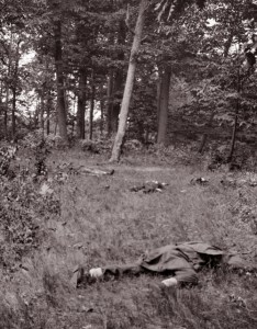
The Battle of the Wilderness (also known as Combats at Parker’s Store, Craig’s Meeting House, Todd’s Tavern, Brock Road, and the Furnaces) took place from May 5-7, 1864 in Spotsylvania County, Virginia as a part of Union General Ulysses S. Grant ’s overland campaign.  Grant’s troops attacked General Robert E. Lee and the Army of Northern Virginia on May 5 and a fierce fight broke out between the soldiers.  There were high casualties on both sides, including Union General James Wadsworth and Confederate General John M. Jones.  The National Park Service’s website provides a detailed overview of the fighting and profiles on various historical figures that fought in the battle.  Teachers may find the suggested reading list and the information for visiting the battlefield posted on the website useful for planning a fieldtrip to the area.  The National Park Service also includes a virtual tour of the battleground for those that cannot make the trip as well as photos of the different sites and monuments.  The Civil War Preservation Trust’s website has some interesting historical maps which may be valuable to take a look at. A study of the Battle of the Wilderness may be useful to incorporate into lessons on African American troops in the Civil War since the 43rd USCT served in the Wilderness Campaign along with other United States Colored Troop regiments.  A previous post outlines the actions of the 43rd USCT during the Wilderness campaign.  Gordon C. Rhea commented on the outcome of the battle in his book:

“The recent carnage could be viewed as the opening salvo of a protracted battle to end the war in Virginia.  Grant’s directive represented the maturation of his thinking.  Lee, Grant was conceding, could not be beaten here.  But the campaign was not over.  Grant would fight again, next time on the fields that offered him the upper hand.  Lincoln’s new commander in chief had been checked, but not defeated. “

no comment

18

Jun

10

The Battle of Ball’s Bluff, October 21, 1861

Posted by rainwatj  Published in Civil War (1861-1865), Images, Letters & Diaries, Maps, Places to Visit Themes: Battles & Soldiers

The Battle of Ball’s Bluff, also known as the Battle of Harrison’s Island or Battle of Leesburg was fought on October 21, 1861 in Loudoun County, Virginia. In response to movement by Confederate Colonel Nathan G. Evans, Union Major General George B. McClellan ordered Brigadier General Charles P. Stone to conduct a “slight demonstration,” a show of force from the Maryland side of the Potomac River without the intention of having any troops cross or combat. After a small encounter with Confederate troops, Union soldiers were ordered to cross over the river into Virginia. Without the necessarily amount of boats, Union soldiers were unable to successfully engage the enemy. This poorly coordinated attack combined with a vigorous counterattack from Confederate soldiers led to a disastrous defeat for the Union including the death of Colonel Edward D. Baker, a United States Senator from Oregon. Estimated casualties for the Union Army totaled over 900 while the Confederates suffered only 150. The defeat had substantial political consequences in Washington D.C. with the establishment of the Congressional Joint Committee on the Conduct of the War.

Ted Ballard’s book Battle of Ball’s Bluff published by the U.S. Army Center of Military History provides the most extensive overview of the battle with a detailed account of the battle including maps, images, bibliographical sketches and further readings . The Library of Congress offers a number of resources including images of Baker’s death and the Union retreat. The Abraham Lincoln Papers at the Library of Congress is another valuable resource that contains transcribed military telegrams between generals and the President. The Ball’s Bluff Battlefield Regional Park and National Cemetery provides visitors a chance to explore the battle site with hiking trails and signs throughout the park. The Northern Virginia Regional Park Authority website also offers worthwhile information regarding the battle including an overview, cultural resources, a downloadable self guided audio tour and detailed battle maps.


no comment

15

Jun

10

The Battle of Olustee (Ocean Pond): February 20, 1864

Posted by rainwatj  Published in Civil War (1861-1865), Historic Periodicals, Images, Letters & Diaries, Maps, Places to Visit Themes: Battles & Soldiers

The Battle of Olustee took place on February 20, 1864 in Baker County, Florida where the Union Army under Brigadier General Truman B. Seymour was defeated and forced to retreat back to Jacksonville in the largest battle fought in Florida during the American Civil War.  Under Brigadier General Joseph Finegan, the reinforced Confederate soldiers inflicted massive casualties on Union troops. Estimates on both sides list the total casualties for the Union Army at 1,860, almost 40% of the participating soldiers and 946 Confederate casualties, 20% of their soldiers at Olustee. Seymour’s army was notable for the participation of three colored regiments; the 8th United States Colored Troops, the 35th United States Colored Troops and the 54th Massachusetts Infantry. For more information on these regiments during Olustee, check out portions of J. Matthew Gallman’s chapter in Wars within a War: Controversy and Conflict over the  American Civil War. Other documents of interest related to the Battle of Olustee can be found in volume 35 of the Official Records.

The most extensive collection of resources can be found at the Battle of Olustee site developed by Thomas R. Fasulo which includes primary sources such as official reports, maps, letters, diaries, images, speeches and periodicals. The Olustee Battlefield Historic State Park commemorates the battle and offers visitors a chance to immerse themselves through walking tours of the battlefield and a visitor center with historical information and artifacts. There is an annual reenactment of the battle in February and a Civil War Expo in September that provides visitors an authentic experience of the battle with hands on activities and historical reenactments


no comment

11

Jun

10

Battle of Kennesaw Mountain

Posted by sailerd  Published in Civil War (1861-1865), Images, Letters & Diaries, Maps, Places to Visit Themes: Battles & Soldiers

The Battle of Kennesaw Mountain took place on June 27, 1864 in Cobb county, Georgia when General William T. Sherman ordered his forces to attack General Joseph E. Johnston’s Army of Tennessee. Sherman, who was unable to dislodge Johnston’s men, was forced to withdraw  later that day. Some estimates put the number of total casualties at 4,000 (3,000 Union, 1,00 CSA). Teachers will find several resources on the National Park Service’s site, including a short overview of the battle and a Google Earth Tour. This viritual tour shows the location of the Confederate and Union forces on the battlefield as well as hiking and horse trails. The Library of Congress also has some resources , including several sketches by Alfred R. Waud and several maps of General Sherman’s Atlanta Campaign. In addition, Google Books has several interesting accounts of the battle. William Chamberlin, who served with the Ohio Infantry Volunteers, decribed the impact on his regiment:

“Kennesaw Mountain! What soldier who saw it during these days will ever forget its fiery flaming brow? Into how many households does the name bring the gushing tears of sorrow for the loved one whose spark of life went out before that death-dealing giant of Nature? Kennesaw Mountain held Sherman’s army at bay fourteen days during which the loss in killed and wounded was greater than at any previous part of the campaign.”

Lieutenant Warren, who served in the Missouri Confederate Brigade, described the “poor fellows” in the “solid line of blue” whose attack was repulsed. One can find other primary sources related to this battle in Cornell University’s Making of America, including General Johnston’s account and other reports in the Official Records.

no comment

8

Jun

10

Battle of Fredericksburg

Posted by sailerd  Published in Civil War (1861-1865), Historic Periodicals, Images, Places to Visit Themes: Battles & Soldiers

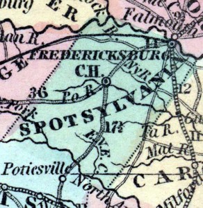
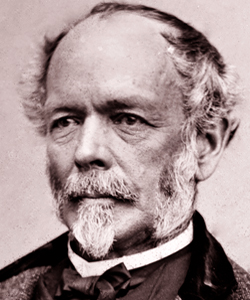
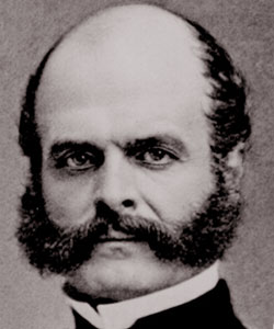
Battle of Fredericksburg took place in Spotsylvania County, Virginia between December 11–15, 1862 and marked General Ambrose Burnside’s first major campaign as commander of Army of the Potomac. While Burnside’s overall objective was to march on Richmond, Virginia, his army had to first successfully cross the Rappahannock river near Fredericksburg. General Robert E. Lee’s Army of Northern Virginia, however, defeated Burnside’s forces and forced them to retreat. Some estimates put the total number of casualties at 17,929 (Union 13,353, CSA 4,576), which included four generals – two Union (C. Feger Jackson and George Bayard) and two Confederate (Thomas R.R. Cobb and Maxey Gregg). The National Park Service’s website on Fredericksburg provides a nice overview of the battle and offers a number of resources. There are over ten galleries of modern and historic photographs, including “Fredericksburg Sketches” and “Historic Photos.” In addition, the site is creating a virtual tour of the battlefield. Anyone planning on a visit should check out their tour options. The Encyclopedia of Virginia, which is produced by the Virginia Foundation for the Humanities, also provides a nice overview of the battle and links to historic images. Other primary sources about this battle are available at Cornell University’s Making of America, which provides digital access to historical periodicals like The Century. In August 1886, this magazine published five articles by officers who were involved in the battle, including General James Longstreet (HD profile / article) and Union Generals Darius Couch (HD profile / article), William Farrah Smith (HD profile / article), and Rush C. Hawkins (article).Longstreet argued that:

“The battle of Fredericksburg was a great and unprofitable sacrifice of human life made, through the pressure from the rear, against a general who should have known better and who doubtless acted against his judgment. If I had been in General Burnside’s place, I would have asked the President to allow me to resign rather than execute his order to force the passage of the river and march the army against Lee in his stronghold.”

You can also find other documents related to this battle in volume 21 of the Official Records.

no comment

8

Jun

10

The First Battle of Bull Run, July 21, 1861

Posted by solnitr  Published in Civil War (1861-1865), Historic Periodicals, Images, Lesson Plans, Maps, Places to Visit Themes: Battles & Soldiers

The artist H. Lovie captured a strange scene on July 21, 1861 in Manassas, Virginia: civilians sitting on a hill overlooking the clash between the Union and Confederate armies.  Lovie’s picture was published in Frank Leslie’s weekly illustrated newspaper, a great visual resource for documenting the Civil War. Both the picnicking residents of Washington DC and Gen. Irvin McDowell’ s troops were unprepared for the hard-fought and bloody Confederate victory at the First Battle of Bull Run (Manassas).  With nearly 5,000 combined casualties, this early battle deflated Northern hopes of a quick and easy war.  General Joseph E. Johnston, commander of the Confederate Armies of the Shenandoah and of the Potomac reflected on their unlikely victory:
  • The admirable character of our troops is incontestably proved by the result of this battle, especially when it is remembered that little more than six thousand men of the Army of the Shenandoah with sixteen guns, and less than two thousand of that of the Potomac with six guns, for full five hours successfully resisted thirty-five thousand U. S. troops with a powerful artillery and superior force of regular cavalry… The unfading honor which they won was dearly bought with the blood of many of our best and bravest.
The Virginia Center for Digital History has created a valuable online resource in their project entitled “Valley of the Shadow” which examines the Civil War through the eyes of Americans on both sides of the conflict. Students can study the 1st Battle at Bull Run by watching 5th Virginia Infantry and 1st Virginia Cavalry’s advance into the battle in the interactive map, read reports by commanding officers, or skim a Pennsylvania newspaper published the weekend following the battle.  The battlefield is preserved by the National Park Service as a national battlefield, and the NPS website provides tools for teachers including lesson plans and field trip outlines.
David Harrison Walton, Dickinson College Class of 1854, fought as part of the Stonewall Brigade during the first Battle at Manassas, as the first commander of the “Shenandoah Sharpshooters”: Company K of the 33rd Virginia.
[flickrslideshow acct_name=”Housedivided” id=”72157624115696017″]
1 comment

7

Jun

10

Battle of Cynthiana: June 11-12, 1864

Posted by mckelveb  Published in Civil War (1861-1865), Maps, Places to Visit, Rare Books Themes: Battles & Soldiers

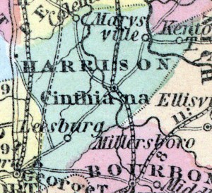
The Battle of Cynthiana (also known as Kellar’s Bridge) took place on June 11-12, 1864 in Harrison County, Kentucky.  The National Park Service ’s website includes a brief summary regarding the battle and the Civil War Sites Advisory Commission provides a map detailing the location of each battleground within the state as well as an overview on the condition of each individual site.  The Cynthiana battleground has over eight hundred acres of land intact that would make field trips and walking tours of the area possible.  On June 11, Confederate General John Hunt Morgan and his forces attacked General Edward Hobson and the 171st Ohio National Guard, taking over one thousand prisoners of war captive.  The following day, Union General Stephen Gano Burbridge along with the 168th Regiment Ohio Volunteer Infantry and the Kentucky Harrison County Home Guards attacked the Confederate forces at dawn and drove them back.  Collins’ Historical Sketches of Kentucky: History of Kentucky, Volume 2 described the scene of the battle:

“Fatigued as they were by the previous day’s operations- which resulted in the defeat and capture of two distinct Federal forces- the Confederates were not in condition to withstand the shock of a fresh body of troops.  Burbridge, with his cavalry, was enabled to flank them, and thus turn their lines; while his infantry, in the center, advanced steadily, forcing them back on the town.  The fighting commenced on Millersburg pike, about one mile east of Cynthiana.  But the Confederates- unable to hold out against the rapid and determined advance of superior numbers of fresh troops supported by artillery- soon gave way, and, by the time they reached Cynthiana, were in full retreat, and the retreat a rout.  One by one, they fell back through the town, crossed the river, and followed the Raven Creek pike.  Thus ended the battle that was fought at Cynthiana in the war for southern independence.”

Some suggestions for further reading on the Battle of Cynthiana include Chronicles of Cynthiana which gives a fairly concise overview of the second battle at the site.  Other interesting resources are the Official Records and the History of Morgan’s Cavalry which provides background information on General Morgan’s early life and his participation in the Confederate army.

no comment
Page 3 of 8«12345...»Last »

Search

Categories

  • Dickinson & Slavery
  • History Online
  • Period
    • 19th Century (1840-1880)
    • Antebellum (1840-1861)
    • Civil War (1861-1865)
    • Reconstruction (1865-1880)
  • Type
    • Editor's Choice
    • General Opinion
    • Historic Periodicals
    • Images
    • Lesson Plans
    • Letters & Diaries
    • Lists
    • Maps
    • Places to Visit
    • Rare Books
    • Recent News
    • Recent Scholarship
    • Recollections
    • Video
  • What Would Lincoln Do?

Project Links

  • Digital Lincoln
  • HDiv Research Engine
  • House Divided Index
  • L-D Debates Classroom
  • Lincoln in PA
  • PA Grand Review
  • UGRR Classroom
  • Virtual Field Trips
  • William Stoker Exhibit

Administration

  • Log in
  • Entries feed
  • Comments feed
  • WordPress.org
Donate

Recent Post

  • Black Employees and Exclusive Spaces: The Dickinson Campus in the Late 19th Century
  • Friend or Foe: Nineteenth Century Dickinson College Students’ Perception of Their Janitors
  • Teaching Gettysburg: New Classroom Resources
  • Coverage of the Gettysburg Address
  • Welcome to Chicago: Choosing the Right Citation Generator
  • Augmented Reality in the Classroom
  • Beyond Gettysburg: Primary Sources for the Gettysburg Campaign
  • African Americans Buried at Gettysburg
  • The Slave Hunt: Amos Barnes and Confederate Policy
  • Entering Oz – Bringing Color to History

Recent Comments

  • George Georgiev in Making Something to Write Home About
  • Matthew Pinsker in The Slave Hunt: Amos Barnes and Confederate Policy…
  • linard johnson in Making Something to Write Home About
  • Bedava in The Slave Hunt: Amos Barnes and Confederate Policy…
  • Adeyinka in Discovering the Story of a Slave Catcher
  • Stefan Papp Jr. in Where was William Lloyd Garrison?
  • Stefan Papp Jr. in Where was William Lloyd Garrison?
  • Jon White in Albert Hazlett - Trial in Carlisle, October 1859
  • Pedro in Discovering the Story of a Slave Catcher
  • Matthew Pinsker in Register Today for "Understanding Lincoln," a New …

by Wired Studios, Corvette Garage, Jeff Mummert
© Content 2007-2010 by Dickinson College