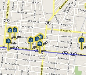
The Shelling of Carlisle Google Map
 The Shelling of Carlisle Map is a virtual tour of the Confederate shelling that occurred on July 1, 1863. The tour begins with the entrance of Major General Fitzhugh Lee into the town of Carlisle and ends at the burning of the Carlisle Barracks. The map is a great resource for those visiting the area and those who want to discover the historical past of Carlisle. Each marker on the map gives a brief explanation of what happened in 1863 and shows the location in town today. Such locations include the Courthouse downtown, the First Presbyterian Church, buildings on Dickinson College’s campus and the Carlisle Barracks. The purple line indicates the location of the railroad that ran through Carlisle during the Civil War. Using this map visitors can explore the town of Carlisle and view its sights.
For more information on the Shelling of Carlisle, view BlogDivided. The House Divided Search engine can provide additional information on Carlisle from the Civil War. Other maps on various Civil War topics can be found on Google Maps.
Leave a Reply