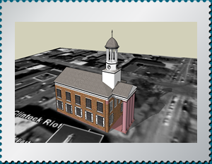
Courthouse in Carlisle, PA – Site of the McClintock Riot in 1847.
Download as a –
SketchUp File

Courthouse in Carlisle, PA – Site of the McClintock Riot in 1847.
Download as a –
SketchUp File
Geographic Information System (GIS) maps are becoming a common tool in academic history and offer an especially useful way to analyze Lincoln and the Civil War era. Whether in political or military history of the period, the ability to generate dynamic maps from wide-ranging data is essential. Here are some examples of maps relevant to the Lincoln-Douglas campaign of 1858, animated by Adobe Flash software to allow users to select their own layers for analysis. The data for these maps comes from Illinois State Archives election returns for 1858 and the U.S. Census in Illinois from 1850 and 1860. Party majority and party strength results are based upon returns for the 1858 state treasurer’s race –the most important statewide race on the ballot in the fall of that year. The Lincoln-Douglas campaign was actually attempting to influence legislative elections on a district-by-district basis since legislatures, not people, still selected U.S. senators in those days. The turnout figures have been estimated by comparing the total vote for state treasurer with the adult white male population on a county-by-county basis.
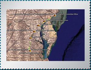
In 1849, Virginia slave Henry Brown (1815-???) escaped to freedom in such a way that he became an immutable subject of Underground Railroad lore. Brown was both a well-treated and skilled slave; however, he became virulently dissatisfied with slavery when his family was sold. Brown befriended Samuel Smith, a merchant, who observed that Brown’s skill with tobacco could sustain him as a free man. Brown made up his mind to escape, and with assistance from a sympathetic free black, constructed a box with dimensions 3 feet by 2 feet by 2 feet. Brown secretly contacted the Philadelphia Anti-Slavery office, and enigmatically alluded to the pending arrival of a box that should be immediately opened. Brown then shipped himself, in the box, to the office. He arrived alive, and now, free, having endured a trek of 350 miles with 3 air holes and minimal provisions. His creative escape earned him the name, Henry “Box” Brown. J. Miller McKim and William Still of the Anti-Slavery Office were among those present at Brown’s “resurrection.”
The Journey of Henry “Box” Brown (Google Earth file)
Teacher’s Guide (Microsoft Word Document)
Social Studies Lesson Plans (Microsoft Word Document)
Interdisciplinary Lesson Plans (Microsoft Word Document)
Learn more about Henry “Box” Brown from Brown’s profile on House Divided.
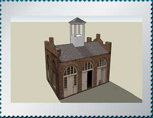
Google SketchUp – Three dimensional models that are placed on the earth at tour sites. The application for viewing these models and creating your own models is free, and available at the Google SketchUp website.
Unfamiliar with Google SketchUp? This 3D development tool works seamlessly with Google Earth, or as a stand alone application. See a tour and tutorials at What is SketchUp?.
The SketchUp file is editable and the model can be viewed from any angle. The Quicktime Movie offers a three dimensional view of the model, but is not interactive.
Google Earth – Interactive tours of places on the earth, including text, images, and links.The application for viewing the tours and places is free, and available at the Google Earth website.
Unfamiliar with Google Earth? This exciting and effective educational tool is explained through images and tutorials at See Google Earth in Action.
If Google Earth AND Google Sketchup are installed on your computer, the three dimensional SketchUp models will be visible as part of the Google Earth tour The models may also be downloaded individually and viewed within the SketchUp application. SketchUp is not required for viewing the Google Earth tours.
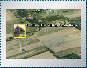
Tour of UGRR sites visited during the NEH Underground Railroad Workshops at Dickinson College
The Complete Landmarks of the Underground Railroad Tour (Google Earth File)
The Complete Landmarks of the Underground Railroad Tour with 3D models (Google Earth File – large file)
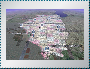
Google Earth Tour of the opening speeches and sites of the Lincoln-Douglas Debates in Illinois in 1858.
Lincoln Douglas Debates (Google Earth File)
Twelve Things You Might Not Know About
The Lincoln-Douglas Debates (Microsoft Word Document)
Learn more about these debates at the Lincoln-Douglas Debates Digital Classroom.
Powered by WordPress & Theme by Anders Norén